دوتنه:Nettuno.jpg

Page contents not supported in other languages.
د ويکيپېډيا، وړیا پوهنغونډ له خوا

اصلي دوتنه(۹۶۰ × ۶۴۳ پېکسل, د دوتنې کچه: ۹۰ کيلوبايټ, MIME بڼه: image/jpeg)

دا دوتنه د ويکيمېډيا کامنز لخوا خپرېږې او کېدای شي چې دا په نورو پروژو هم کارېدلې وي. د دوتنې د کارېدنې لا نور مالومات د دوتنې د څرگندنو په مخ کې لاندې ښودل شوی.

لنډيز

څرگندونه
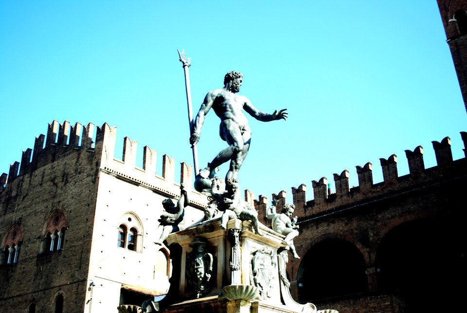
Italiano: Fontana del Nettuno - MIBAC
This is a photo of a monument which is part of cultural heritage of Italy. This monument participates in the contest Wiki Loves Monuments Italia . See authorisations.
(wiki-ID: 037006698-MIBAC)
Italy-MiBAC-disclaimer Further authorizations required by the Italian "Code of Cultural Heritage and Landscape" (Codice Urbani), under Legislative Decree No. 42, dated January 22, 2004, and its subsequent amendments, regarding the reuse of the picture.
This image reproduces a property belonging to the Italian cultural heritage as entrusted to the Italian government. Such images are regulated by Articles 106 et seq. of the Italian Code of Cultural Heritage and Landscape under Legislative Decree No. 42, dated January 22, 2004, and its subsequent amendments. These regulations, unrelated to copyright regulations, establish a system for the protection of Italy’s historic and artistic heritage and its standards of dignity. Among other things, these regulations provide for the payment of a concession fee by those who intend to benefit economically from reproductions of property belonging to the Italian cultural heritage. Reproduction of this image is permitted for personal use or study. A further authorization by the Italian Ministry of Heritage and Culture is required for reproduction for any other purpose, and particularly for commercial use. Such commercial use includes, but is not limited to, use in (a) any form of advertising, and (b) any company name, logo, trademark, image, activity, or product.
Italy
نېټه
سرچينه شخصي اثر
ليکوال Serenazammartini
Camera location۴۴° ۲۹′ ۳۹٫۲۳″ N, ۱۱° ۲۰′ ۳۳٫۶۱″ E Kartographer map based on OpenStreetMap.View this and other nearby images on: OpenStreetMapinfo

منښتليک:

زه، د دې اثر د خپرولو او لمېسلو خاوند، دا دوتنه د لاندې منښتليک پر بنسټ دلته خپروم:
w:ps:کريېټيو کامانز
اړوندېدنه يوشان شريکول
دا دوتنه د کريټيف کامنز Attribution-Share Alike 3.0 Unported په منښتليک سمبال ده.
تاسې کولی شئ چې:
  • بيا يې د نورو سره شريک کړئ – همدا اثر ولمېسئ، و وېشئ او بيا يې خپور کړئ
  • بيا ادلون بدلون راولئ – بدل شوی اثر خپل کړئ
د لاندې شرطونو له مخې:
  • اړوندېدنه – تاسې بايد دا اثر د ليکوال يا منښتگر لخوا د ځانگړو شويو اصولو سره اړونده وگڼئ (خو په دې توگه نه چې داسې ښکاره شي چې گنې تاسې يا ستاسې لخوا کارېدنه د اثر د ملاتړ سبب شوی)
  • يوشان شريکول – که تاسې همدا اثر بدلوئ، رغوئ، او يا يې هم سر له نوي جوړوئ نو په پايله کې رامېنځ ته شوی اثر به يوازې د همدې دوتنې ورته منښتليک پر بنسټ خپروئ.


Captions

Add a one-line explanation of what this file represents

Items portrayed in this file

depicts انګليسي

some value

object has role انګليسي: photographer انګليسي
author name string انګليسي: Serenazammartini

copyright status انګليسي

copyrighted انګليسي

source of file انګليسي

۱۵ جنوري 2012

44°29'39.23"N, 11°20'33.61"E

participant in انګليسي

media type انګليسي

image/jpeg

د دوتنې پېښليک

په يوې نېټې/يوه وخت وټوکۍ چې د هماغه وخت او نېټې دوتنه چې څنگه ښکارېده هماغسې درښکاره شي.

نېټه/وختبټنوکډډېکارنتبصره
اوسنی۱۳:۴۳, ۲۵ سپټمبر ۲۰۱۲د ۱۳:۴۳, ۲۵ سپټمبر ۲۰۱۲ پورې د بټنوک بڼه۹۶۰ × ۶۴۳ (۹۰ کيلوبايټ)SerenazammartiniUser created page with UploadWizard

دا لاندينی مخ د همدې دوتنې سره تړنې لري:

مېټاډاټا