
دوتنه:Iran counties.png

د همدې ليدنې کچه: ۸۰۰ × ۵۴۸ پېکسل. نورې ژورليدنې: ۳۲۰ × ۲۱۹ پېکسل | ۶۴۰ × ۴۳۹ پېکسل | ۱٬۰۲۴ × ۷۰۲ پېکسل | ۱٬۲۸۱ × ۸۷۸ پېکسل.
اصلي دوتنه (۱٬۲۸۱ × ۸۷۸ پېکسل, د دوتنې کچه: ۶۶ کيلوبايټ, MIME بڼه: image/png)
لنډيز

|
File:Iran Counties.svg is a vector version of this file. It should be used in place of this PNG file when not inferior.
File:Iran counties.png → File:Iran Counties.svg
For more information, see Help:SVG. |
 |
| څرگندونه |
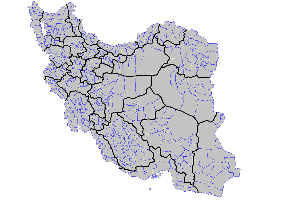
English: Map of the counties (shahrestanha) of Iran. Created using MapInfo Professional v8.5 and various mapping resources.
فارسی: نقشهٔ شهرستانهای ایران. |
| نېټه | |
| سرچينه | شخصي اثر |
| ليکوال | Rarelibra |
| نورې بڼې | Derivative works of this file: نتیجهٔ انتخابات ۱۳۹۲.png |
منښتليک:
| I, the copyright holder of this work, release this work into the public domain. This applies worldwide. In some countries this may not be legally possible; if so: I grant anyone the right to use this work for any purpose, without any conditions, unless such conditions are required by law. |
د دوتنې پېښليک
په يوې نېټې/يوه وخت وټوکۍ چې د هماغه وخت او نېټې دوتنه چې څنگه ښکارېده هماغسې درښکاره شي.
| نېټه/وخت | بټنوک | ډډې | کارن | تبصره | |
|---|---|---|---|---|---|
| اوسنی | ۱۸:۴۱, ۴ نومبر ۲۰۱۹ | | ۱٬۲۸۱ × ۸۷۸ (۶۶ کيلوبايټ) | BasilLeaf | 7 new counties in Fars: Bakhtegan, Beyza, Evaz, Khafr, Kuh Chenar, Sar chahan, Zarqan |
| ۰۷:۵۵, ۱۹ اپرېل ۲۰۱۴ |  | ۱٬۲۸۱ × ۸۷۸ (۶۲ کيلوبايټ) | Haghal Jagul | بروزرسانی کلی | |
| ۱۰:۵۵, ۲۳ جون ۲۰۱۳ |  | ۱٬۲۸۱ × ۸۷۸ (۶۶ کيلوبايټ) | BasilLeaf | بروزرسانی کلی | |
| ۲۳:۵۴, ۸ جون ۲۰۱۳ |  | ۱٬۲۸۱ × ۸۷۸ (۶۸ کيلوبايټ) | BasilLeaf | Design changed | |
| ۲۳:۳۵, ۹ جنوري ۲۰۱۱ |  | ۱٬۲۸۱ × ۸۷۸ (۸۳ کيلوبايټ) | BasilLeaf | Updated and provinces showed. | |
| ۲۱:۳۴, ۱ مې ۲۰۰۷ |  | ۱٬۲۸۱ × ۸۷۸ (۳۵ کيلوبايټ) | Rarelibra | Map of the counties (shahrestanha) of Iran. Created by ~~~~ for public domain use, using MapInfo Professional v8.5 and various mapping resources. |
د دوتنې کارېدنه
داسې هېڅ کوم مخ نه شته چې د دغې دوتنې سره تړنې ولري.
د نړېوالې دوتنې کارېدنه
همدا دوتنه لاندينۍ نورې ويکي گانې کاروي:
- په arz.wikipedia.org کارونې
- په en.wikipedia.org کارونې
- په fa.wikipedia.org کارونې
- په incubator.wikimedia.org کارونې
- په pnb.wikipedia.org کارونې
- برازجان
- شہرستان شہریار
- شہرستان رباط کریم
- شہرستان ورامین
- شہرستان اسلام شہر
- شہرستان رے
- شہرستان تہران
- شہرستان شیراز
- ورامین
- رے
- شہریار
- اسلام شہر
- شہرستان فیروزکوہ
- رباط کریم
- شہرستان دماوند
- شہرستان خلخال
- شہرستان بیلہ سوار
- شہرستان اردبیل
- شہرستان شیمیرانت
- شہرستان گرمی
- شہرستان کوثر
- شہرستان شہر قدس
- شہرستان پاک دشت
- شہرستان ملارد
- شہرستان یزد
- شہرستان قزوین
- شہرستان اراک
- شہرستان زاہدان
- شہرستان رشت
- شہرستان ہمدان
- شہرستان کرمان
- شہرستان ارومیہ
- شہرستان کرمانشاہ
- شہرستان قم
- شہرستان اہواز
- شہرستان تبریز
- شہرستان کرج
- شہرستان اصفہان
- شہرستان مشہد
- شہرستان نیر
- شہرستان پارس آباد
- شہرستان نمین
- شہرستان مشگین شہر
د دې دوتنې نورې نړېوالې کارېدنې کتل.