
دوتنه:Arabian Peninsula (orthographic projection).png

د همدې ليدنې کچه: ۶۰۰ × ۶۰۰ پېکسل. نورې ژورليدنې: ۲۴۰ × ۲۴۰ پېکسل | ۴۸۰ × ۴۸۰ پېکسل | ۷۶۸ × ۷۶۸ پېکسل | ۱٬۰۲۴ × ۱٬۰۲۴ پېکسل | ۲٬۰۰۰ × ۲٬۰۰۰ پېکسل.
اصلي دوتنه (۲٬۰۰۰ × ۲٬۰۰۰ پېکسل, د دوتنې کچه: ۶۶۶ کيلوبايټ, MIME بڼه: image/png)
.png)
لنډيز
| څرگندونه |
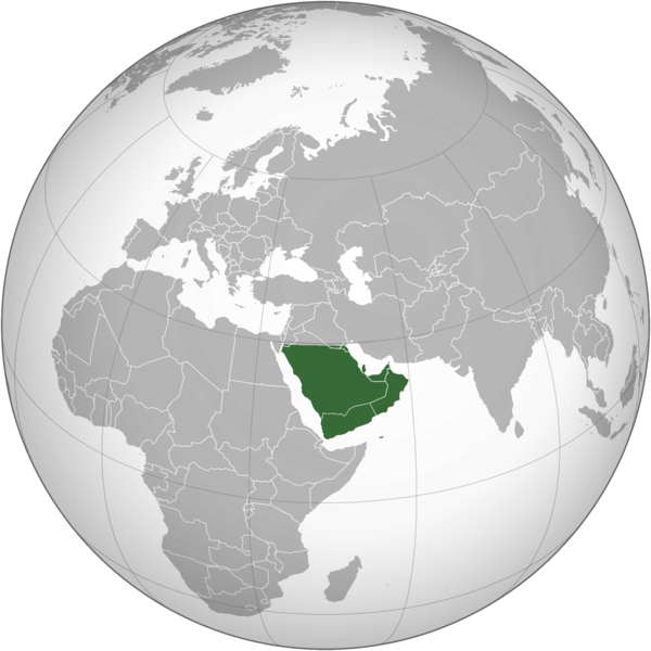
English: The Arabian Peninsula العربية: شبه الجزيرة العربية |
| نېټه | |
| سرچينه | شخصي اثر |
| ليکوال | Afrogindahood |
منښتليک:
| This map is ineligible for copyright and therefore in the public domain, because it consists entirely of information that is common property and contains no original authorship. For more information, see Commons:Threshold of originality § Maps.
|
د دوتنې پېښليک
په يوې نېټې/يوه وخت وټوکۍ چې د هماغه وخت او نېټې دوتنه چې څنگه ښکارېده هماغسې درښکاره شي.
| نېټه/وخت | بټنوک | ډډې | کارن | تبصره | |
|---|---|---|---|---|---|
| اوسنی | ۱۴:۱۴, ۷ مارچ ۲۰۲۳ | | ۲٬۰۰۰ × ۲٬۰۰۰ (۶۶۶ کيلوبايټ) | Treetoes023 | Reverted to version as of 23:11, 6 January 2020 (UTC): This version shows the geographic Arabian Peninsula. |
| ۲۱:۲۴, ۲۴ جنوري ۲۰۲۰ |  | ۲٬۰۰۰ × ۲٬۰۰۰ (۳۹۹ کيلوبايټ) | Ham105 | Reverted to version as of 03:49, 7 March 2015 (UTC) | |
| ۲۳:۱۱, ۶ جنوري ۲۰۲۰ |  | ۲٬۰۰۰ × ۲٬۰۰۰ (۶۶۶ کيلوبايټ) | Sariyr | Reverted to version as of 22:23, 4 January 2020 (UTC): Northern border line between the Gulf of Aqaba and the Kuwait Bay. | |
| ۰۴:۰۶, ۵ جنوري ۲۰۲۰ |  | ۲٬۰۰۰ × ۲٬۰۰۰ (۳۹۹ کيلوبايټ) | Ham105 | Reverted to version as of 03:49, 7 March 2015 (UTC) unsourced - take it to the discussion page | |
| ۲۲:۲۳, ۴ جنوري ۲۰۲۰ |  | ۲٬۰۰۰ × ۲٬۰۰۰ (۶۶۶ کيلوبايټ) | Sariyr | Reverted to version as of 02:46, 4 January 2020 (UTC): Northern border line between the Gulf of Akaba an the Kuwait Bay. | |
| ۱۵:۳۷, ۴ جنوري ۲۰۲۰ |  | ۲٬۰۰۰ × ۲٬۰۰۰ (۳۹۹ کيلوبايټ) | Ham105 | Reverted to version as of 03:49, 7 March 2015 (UTC) | |
| ۰۲:۴۶, ۴ جنوري ۲۰۲۰ |  | ۲٬۰۰۰ × ۲٬۰۰۰ (۶۶۶ کيلوبايټ) | Sariyr | Northern border line between the Gulf of Akaba an the Kuwait Bay. | |
| ۰۳:۴۹, ۷ مارچ ۲۰۱۵ |  | ۲٬۰۰۰ × ۲٬۰۰۰ (۳۹۹ کيلوبايټ) | Afrogindahood | User created page with UploadWizard |
د دوتنې کارېدنه
دا لاندينی مخ د همدې دوتنې سره تړنې لري:
د نړېوالې دوتنې کارېدنه
همدا دوتنه لاندينۍ نورې ويکي گانې کاروي:
- په ar.wikipedia.org کارونې
- په arz.wikipedia.org کارونې
- په azb.wikipedia.org کارونې
- په bn.wikipedia.org کارونې
- په ckb.wikipedia.org کارونې
- په cs.wikipedia.org کارونې
- په el.wikiversity.org کارونې
- په en.wikipedia.org کارونې
- په fa.wikipedia.org کارونې
- په he.wikipedia.org کارونې
- په hy.wikipedia.org کارونې
- په hyw.wikipedia.org کارونې
- په id.wikipedia.org کارونې
- په it.wikivoyage.org کارونې
- په kn.wikipedia.org کارونې
- په mrj.wikipedia.org کارونې
- په pnb.wikipedia.org کارونې
- په pt.wikipedia.org کارونې
- په sc.wikipedia.org کارونې
- په si.wikipedia.org کارونې
- په sl.wikipedia.org کارونې
- په sr.wikipedia.org کارونې
- په th.wikipedia.org کارونې
- په ur.wikipedia.org کارونې
- په uz.wikipedia.org کارونې
- په vi.wikipedia.org کارونې
.png)