
دوتنه:Map of Brussels around 1699 - 1706.jpg
د همدې ليدنې کچه: ۷۷۵ × ۵۹۹ پېکسل. نورې ژورليدنې: ۳۱۰ × ۲۴۰ پېکسل | ۶۲۱ × ۴۸۰ پېکسل | ۹۹۳ × ۷۶۸ پېکسل | ۱٬۰۸۱ × ۸۳۶ پېکسل.
اصلي دوتنه (۱٬۰۸۱ × ۸۳۶ پېکسل, د دوتنې کچه: ۳۸۳ کيلوبايټ, MIME بڼه: image/jpeg)
لنډيز
| څرگندونه |
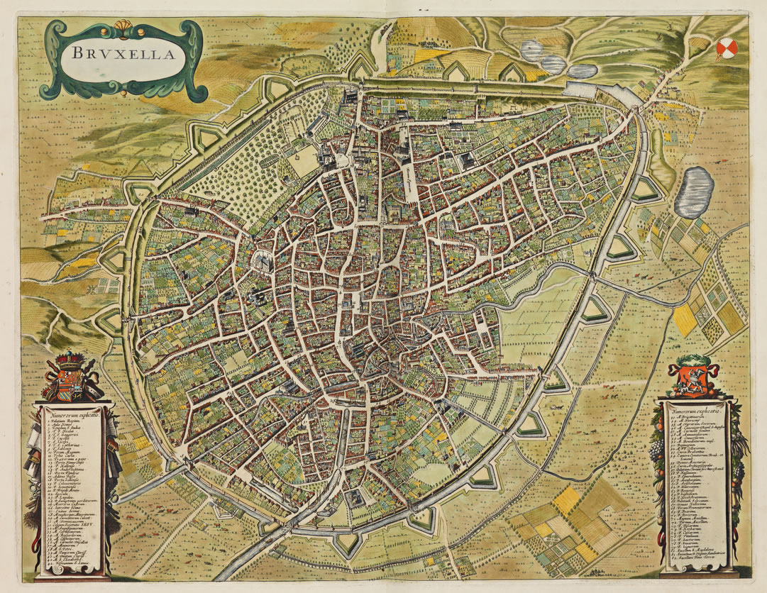
English: Map of Brussels around 1699 - 1706.
Français : Plan de Bruxelles vers 1699 - 1706.
Nederlands: Kaart van Brussel rond 1699 - 1706. |
| نېټه | |
| سرچينه | https://www.wdl.org/en/item/14419/ |
| ليکوال | Frederik de Wit (1630 -1706) |
منښتليک:
|
This work is in the public domain in its country of origin and other countries and areas where the copyright term is the author's life plus 70 years or fewer. This work is in the public domain in the United States because it was published (or registered with the U.S. Copyright Office) before January 1, 1929. | |
| This file has been identified as being free of known restrictions under copyright law, including all related and neighboring rights. | |
د دوتنې پېښليک
په يوې نېټې/يوه وخت وټوکۍ چې د هماغه وخت او نېټې دوتنه چې څنگه ښکارېده هماغسې درښکاره شي.
| نېټه/وخت | بټنوک | ډډې | کارن | تبصره | |
|---|---|---|---|---|---|
| اوسنی | ۱۹:۱۵, ۲۸ سپټمبر ۲۰۲۱ | | ۱٬۰۸۱ × ۸۳۶ (۳۸۳ کيلوبايټ) | KingBaudoin | Uploaded a work by Frederik de Wit (1630 -1706) from https://www.wdl.org/en/item/14419/ with UploadWizard |
د دوتنې کارېدنه
دا 4 لانديني مخونه د همدې دوتنې سره تړنې لري: