
دوتنه:Mali (orthographic projection).svg

Size of this PNG preview of this SVG file: ۵۵۰ × ۵۵۰ پېکسل. نورې ژورليدنې: ۲۴۰ × ۲۴۰ پېکسل | ۴۸۰ × ۴۸۰ پېکسل | ۷۶۸ × ۷۶۸ پېکسل | ۱٬۰۲۴ × ۱٬۰۲۴ پېکسل | ۲٬۰۴۸ × ۲٬۰۴۸ پېکسل.
اصلي دوتنه (SVG دوتنه، نومېنلي ۵۵۰ × ۵۵۰ پېکسل، د دوتنې کچه: ۸۳ کيلوبايټ)
je besoin de kate
لنډيز
| څرگندونه |
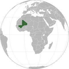
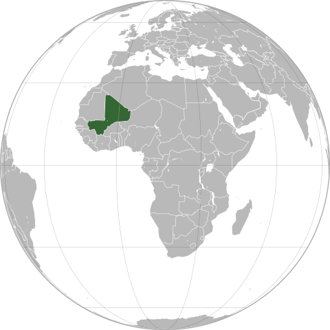
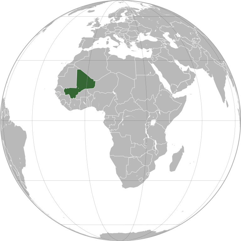
English: Mali (orthographic projection)
Português: Mali (projeção ortográfica)
Español: Mali (proyección ortográfica) |
||
| نېټه | |||
| سرچينه | شخصي اثر | ||
| ليکوال | Marcos Elias de Oliveira Júnior | ||
| اجازه (دا دوتنه بيا کارول) |
|
||
| نورې بڼې |
|
.svg)
.svg)
.svg)
.svg)
.svg)
.svg)
.svg)
.svg)
.svg)
.svg)
.svg)
.svg)
.svg)
.svg)
.svg)
.svg)
.svg)
.svg)
.svg)
.svg)
.svg)
.svg)
.svg)
.svg)
.svg)
.svg)
.svg)
.svg)
.svg)
.svg)
.svg)
.svg)
.svg)
.svg)
.svg)
.svg)
.svg)
.svg)
.svg)
.svg)
.svg)
.svg)
.svg)
.svg)
.svg)
.svg)
.svg)
.svg)
.svg)
.svg)
.svg)
.svg)
.svg)
.svg)
.svg)
.svg)
.svg)
.svg)
.svg)
.svg)
.svg)
.svg)
.svg)
.svg)
.svg)
.svg)
.svg)
.svg)
.svg)
.svg)
.svg)
.svg)
.svg)
.svg)

.svg)

.svg)

.svg)
.svg)
.svg)
.svg)
.svg)
.svg)
.svg)


.svg)
.svg)
.svg)
.svg)
.svg)
.svg)
.svg)

.svg)
.svg)
.svg)
.svg)
.svg)
.svg)
.svg)
.svg)
.svg)
.svg)

.svg)
.svg)
.svg)
.svg)
.svg)
.svg)
.svg)
_without_national_boundaries.svg)
.svg)
.svg)
.svg)
.svg)
.svg)
.svg)

.svg)
.svg)
.png)
.svg)
.svg)
.svg)
.svg)

.svg)
.svg)
.svg)
.svg)
.svg)
.svg)
.svg)
.svg)
.svg)
.svg)
.svg)

.svg)
.svg)
.svg)
.svg)
.svg)
.svg)
.svg)
.svg)
.svg)

.svg)
.svg)

.svg)
.svg)
.svg)
.svg)
.svg)
.svg)
.svg)
.svg)
.svg)
.svg)
.svg)
.svg)
.svg)
.svg)
.svg)
.svg)
.svg)
.svg)
.svg)
.svg)
.svg)
.svg)
.svg)
.svg)
.svg)
.svg)
.svg)
_-_Crimea_disputed.svg)
.svg)
.svg)
.svg)
.svg)
.svg)
.svg)
.svg)
.svg)
.svg)
.svg)
.svg)
_political.svg)
.svg)
.svg)
.svg)
.svg)
_-_Crimea_disputed_-_no_borders.svg)
.svg)
.svg)
.svg)
.svg)
.svg)
.svg)
.svg)
.svg)
.svg)
.svg)
.svg)

.svg)
.svg)
.svg)

.png)
.svg)
.svg)
.svg)
.svg)
.svg)
.svg)
.svg)
.svg)
.svg)
.svg)
.svg)
.svg)
.svg)
.svg)
.svg)
.svg)
.svg)
.svg)
.svg)
.svg)
.svg)
.svg)
.svg)
.svg)
.svg)
.svg)
.svg)
.svg)
.svg)
.svg)
.svg)
.svg)
.svg)
.svg)
.png)
.svg)
.svg)
.svg)
_(orthographic_projection).png)
.svg)
| Orthographic projections maps created by Ssolbergj |
|---|
| Orthographic projections maps created by Ssolbergj: |
.svg)
.svg)
د دوتنې پېښليک
په يوې نېټې/يوه وخت وټوکۍ چې د هماغه وخت او نېټې دوتنه چې څنگه ښکارېده هماغسې درښکاره شي.
.svg&dir=prev)
.svg&offset=20120612133023)
.svg&offset=&limit=20)
.svg&offset=&limit=50)
.svg&offset=&limit=100)
.svg&offset=&limit=250)
.svg&offset=&limit=500)
| نېټه/وخت | بټنوک | ډډې | کارن | تبصره | |
|---|---|---|---|---|---|
| اوسنی | ۲۲:۰۴, ۱۸ جولای ۲۰۲۲ | | ۵۵۰ × ۵۵۰ (۸۳ کيلوبايټ) | M.Bitton | added the missing border between Ethiopia and Eritrea, per request |
| ۲۱:۴۰, ۱۲ سپټمبر ۲۰۱۲ |  | ۵۵۰ × ۵۵۰ (۱۰۸ کيلوبايټ) | Palosirkka | Scrubbed with http://codedread.com/scour/ | |
| ۱۱:۵۹, ۱۹ جولای ۲۰۱۲ |  | ۵۵۰ × ۵۵۰ (۲۸۴ کيلوبايټ) | Chipmunkdavis | http://www.france24.com/en/20120712-al-qaeda-linked-islamists-drive-malis-tuaregs-last-stronghold-ansogo-timbuktu-mnla-ansar-dine-mujao MNLA fully removed, Asar Dine does not claim independence. Azawad no longer exists as a state. | |
| ۰۱:۱۹, ۲ جولای ۲۰۱۲ |  | ۵۵۰ × ۵۵۰ (۲۳۶ کيلوبايټ) | Chipmunkdavis | MNLA still claims they control everything outside the three major towns, [http://www.timeslive.co.za/africa/2012/06/30/islamists-destroy-mali-world-heritage-sites]. Discussion ongoing at en:Talk:List of States with Limited Recognition | |
| ۱۷:۱۸, ۳۰ جون ۲۰۱۲ |  | ۵۵۰ × ۵۵۰ (۲۸۴ کيلوبايټ) | Aotearoa | Reverted to version as of 22:34, 12 June 2012, Independent Azawad is not existed at the moment (territory under administration of anti-independent Ansar Dine | |
| ۲۱:۲۶, ۱۳ جون ۲۰۱۲ |  | ۵۵۰ × ۵۵۰ (۲۳۶ کيلوبايټ) | Chipmunkdavis | Reverted to version as of 14:18, 12 June 2012 Unexplained revert against talk consensus | |
| ۲۲:۳۴, ۱۲ جون ۲۰۱۲ |  | ۵۵۰ × ۵۵۰ (۲۸۴ کيلوبايټ) | Boudoul | Reverted to version as of 13:30, 12 June 2012 | |
| ۲۲:۳۴, ۱۲ جون ۲۰۱۲ |  | ۵۵۰ × ۵۵۰ (۲۸۴ کيلوبايټ) | Boudoul | Reverted to version as of 13:30, 12 June 2012 | |
| ۱۴:۱۸, ۱۲ جون ۲۰۱۲ |  | ۵۵۰ × ۵۵۰ (۲۳۶ کيلوبايټ) | Chipmunkdavis | For most of the countries to which it applies, it is used. See talk page for further discussion. | |
| ۱۳:۳۰, ۱۲ جون ۲۰۱۲ |  | ۵۵۰ × ۵۵۰ (۲۸۴ کيلوبايټ) | Boudoul | Outside of central government control will be true for so many countries - that's a ridiculous reason. |
د دوتنې کارېدنه
داسې هېڅ کوم مخ نه شته چې د دغې دوتنې سره تړنې ولري.
د نړېوالې دوتنې کارېدنه
همدا دوتنه لاندينۍ نورې ويکي گانې کاروي:
- په ace.wikipedia.org کارونې
- په ami.wikipedia.org کارونې
- په ang.wikipedia.org کارونې
- په ar.wikipedia.org کارونې
- مالي
- مستخدم:جار الله/قائمة صور مقالات العلاقات الثنائية
- العلاقات الأمريكية المالية
- العلاقات الأنغولية المالية
- العلاقات الكورية الجنوبية المالية
- العلاقات الإريترية المالية
- العلاقات السويسرية المالية
- العلاقات الألمانية المالية
- العلاقات الليختنشتانية المالية
- العلاقات البوليفية المالية
- العلاقات المالية الموزمبيقية
- العلاقات الألبانية المالية
- العلاقات البلجيكية المالية
- العلاقات الإثيوبية المالية
- العلاقات البيلاروسية المالية
- العلاقات الطاجيكستانية المالية
- العلاقات الروسية المالية
- العلاقات الرومانية المالية
- العلاقات الأرجنتينية المالية
- العلاقات الغامبية المالية
- العلاقات القبرصية المالية
- العلاقات السيراليونية المالية
- العلاقات المالية النيبالية
- العلاقات الليبيرية المالية
- العلاقات التشيكية المالية
- العلاقات المالية الميانمارية
- العلاقات العراقية المالية
- العلاقات البريطانية المالية
- العلاقات الكندية المالية
- العلاقات الكوبية المالية
- العلاقات الكورية الشمالية المالية
- العلاقات الكوستاريكية المالية
- العلاقات الكولومبية المالية
- العلاقات الكيريباتية المالية
- العلاقات الكينية المالية
- العلاقات اللاتفية المالية
- العلاقات اللاوسية المالية
- العلاقات اللبنانية المالية
- العلاقات اللوكسمبورغية المالية
- العلاقات الليبية المالية
- العلاقات الليتوانية المالية
- العلاقات الليسوتوية المالية
- العلاقات المالاوية المالية
- العلاقات المالطية المالية
- العلاقات المالية النيجيرية
- العلاقات المالية الناوروية
- العلاقات المالية المصرية
د دې دوتنې نورې نړېوالې کارېدنې کتل.
.svg)
.svg)