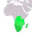
دوتنه:LocationSouthernAfrica.png
LocationSouthernAfrica.png (۳۵۹ × ۳۵۹ پېکسل, د دوتنې کچه: ۸ کيلوبايټ, MIME بڼه: image/png)
د دوتنې پېښليک
په يوې نېټې/يوه وخت وټوکۍ چې د هماغه وخت او نېټې دوتنه چې څنگه ښکارېده هماغسې درښکاره شي.
| نېټه/وخت | بټنوک | ډډې | کارن | تبصره | |
|---|---|---|---|---|---|
| اوسنی | ۱۳:۱۶, ۱۱ نومبر ۲۰۲۲ |  | ۳۵۹ × ۳۵۹ (۸ کيلوبايټ) | ColorfulSmoke | . |
| ۱۱:۵۵, ۱۱ نومبر ۲۰۲۲ |  | ۳۶۰ × ۳۵۹ (۸ کيلوبايټ) | ColorfulSmoke | ||
| ۱۶:۵۴, ۱۷ مارچ ۲۰۱۸ |  | ۳۶۰ × ۳۹۲ (۱۱ کيلوبايټ) | Maphobbyist | Upload | |
| ۲۱:۲۲, ۹ جولای ۲۰۱۱ |  | ۳۶۰ × ۳۹۲ (۱۴ کيلوبايټ) | Maphobbyist | South Sudan has become independent on July 9, 2011. Sudan and South Sudan are shown with the new international border between them. | |
| ۰۸:۱۱, ۱۱ ډيسمبر ۲۰۰۷ |  | ۳۶۰ × ۳۹۲ (۱۴ کيلوبايټ) | Hoshie | added Cabinda (Angola) and Montenegro. | |
| ۱۶:۰۱, ۲ اپرېل ۲۰۰۶ |  | ۳۶۰ × ۳۹۲ (۹ کيلوبايټ) | E Pluribus Anthony~commonswiki | Reverted to earlier revision | |
| ۰۵:۴۵, ۱ اپرېل ۲۰۰۶ |  | ۳۶۰ × ۳۹۲ (۱۴ کيلوبايټ) | Aris Katsaris | Cleaner -- there's no need to include SADC at all here. | |
| ۱۸:۴۱, ۵ فبروري ۲۰۰۶ |  | ۳۶۰ × ۳۹۲ (۹ کيلوبايټ) | E Pluribus Anthony~commonswiki | Map: Southern Africa (location) |
د دوتنې کارېدنه
دا لاندينی مخ د همدې دوتنې سره تړنې لري:
د نړېوالې دوتنې کارېدنه
همدا دوتنه لاندينۍ نورې ويکي گانې کاروي:
- په ace.wikipedia.org کارونې
- په af.wikipedia.org کارونې
- په als.wikipedia.org کارونې
- په am.wikipedia.org کارونې
- په ar.wikipedia.org کارونې
- ليبيا
- جيبوتي
- موريتانيا
- تونس
- السودان
- الصحراء الغربية
- أنغولا
- أوغندا
- إسبانيا
- تشاد
- النيجر
- مالي
- السنغال
- غامبيا
- غينيا بيساو
- غينيا
- سيراليون
- ليبيريا
- غانا
- توغو
- بنين
- بوركينا فاسو
- الصومال
- كينيا
- تنزانيا
- الغابون
- زامبيا
- موزمبيق
- زيمبابوي
- البرتغال
- الكاميرون
- جمهورية الكونغو الديمقراطية
- بوتسوانا
- جنوب إفريقيا
- جمهورية إفريقيا الوسطى
- جمهورية الكونغو
- سيشل
- ناميبيا
- مدغشقر
- ليسوتو
- موريشيوس
- نهر النيل
د دې دوتنې نورې نړېوالې کارېدنې کتل.

