
دوتنه:LocationNorthKorea.png
تر دې کچې لوړې بېلن نښې نشته.
LocationNorthKorea.png (۲۵۰ × ۱۱۵ پېکسل, د دوتنې کچه: ۶ کيلوبايټ, MIME بڼه: image/png)

|
File:Locator map of North Korea.svg is a vector version of this file. It should be used in place of this PNG file when not inferior.
File:LocationNorthKorea.png → File:Locator map of North Korea.svg
For more information, see Help:SVG. |
 |
|
|
File:LocationNorthKorea.svg is a vector version of this file. It should be used in place of this PNG file when not inferior.
File:LocationNorthKorea.png → File:LocationNorthKorea.svg
For more information, see Help:SVG. |
 |
لنډيز
| څرگندونه | |
| سرچينه | English Wikipedia |
| ليکوال | Vardion |
| نورې بڼې |
|
منښتليک:
| |
This work has been released into the public domain by its author, Vardion, at the انګليسي ويکيپېډيا project. This applies worldwide. In case this is not legally possible: |
د دوتنې پېښليک
په يوې نېټې/يوه وخت وټوکۍ چې د هماغه وخت او نېټې دوتنه چې څنگه ښکارېده هماغسې درښکاره شي.
| نېټه/وخت | بټنوک | ډډې | کارن | تبصره | |
|---|---|---|---|---|---|
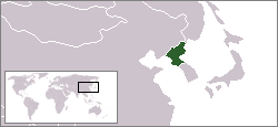
| اوسنی | ۰۲:۵۸, ۲۳ ډيسمبر ۲۰۰۴ | | ۲۵۰ × ۱۱۵ (۶ کيلوبايټ) | EugeneZelenko | Location map for the North Korea.<br/>Originally created for English Wikipedia by Vardion.<br/>{{PD}}<br/>Category:Country locator maps |
د دوتنې کارېدنه
داسې هېڅ کوم مخ نه شته چې د دغې دوتنې سره تړنې ولري.
د نړېوالې دوتنې کارېدنه
همدا دوتنه لاندينۍ نورې ويکي گانې کاروي:
- په ar.wikinews.org کارونې
- الرئيس الأمريكي الأسبق بيل كلينتون يلتقي رئيس كوريا الشمالية
- قالب:كوريا الشمالية
- كوريا الشمالية تنوي إطلاق قمر صناعي في هذا الشهر
- كوريا الديمقراطية تعلن إلغاء اتفاقية عدم الاعتداء مع كوريا الجنوبية
- بعد زوج عمته "كيم جونغ أون" يعدم وزير الدفاع
- كوريا الشمالية تتحدى أميركا بصاروخ "مجهول الطراز"
- كوريا الشمالية: واشنطن تدفعنا لحرب نووية
- دلائل على تورط كوريا الشمالية في هجوم "الفدية"
- كوريا الشمالية تؤكد نجاح تجربتها الصاروخية الأخيرة
- كوريا الشمالية تطلق مجموعة من الصواريخ التجريبية
- كوريا الشمالية تعلن نجاح إطلاق صاروخ عابر للقارات
- كوريا الشمالية تضع خطة لضرب غوام الأمريكية
- ري يونج: ترمب أشعل فتيل الحرب
- كوريا الشمالية تعلن أنها أصبحت دولة نووية
- كيم: زر القنبلة النووية موجود على مكتبي دائماً
- محادثات بين الكوريتين الأولى من نوعها منذ عامين
- 70 مليون إنسان يعانون من أزمات بصمت
- عقلية انتحارية: عن الحرب المرتقَبة في شمال شرق آسيا
- په ast.wikipedia.org کارونې
- په bg.wikipedia.org کارونې
- په bn.wikipedia.org کارونې
- په bo.wikipedia.org کارونې
- په bpy.wikipedia.org کارونې
- په br.wikipedia.org کارونې
- په bs.wikipedia.org کارونې
- په cbk-zam.wikipedia.org کارونې
- په csb.wikipedia.org کارونې
- په de.wikinews.org کارونې
- په de.wikivoyage.org کارونې
- په de.wiktionary.org کارونې
- په dsb.wikipedia.org کارونې
- په dz.wikipedia.org کارونې
- په el.wiktionary.org کارونې
- په en.wikipedia.org کارونې
- په en.wikinews.org کارونې
- په en.wikivoyage.org کارونې
- په en.wiktionary.org کارونې
- په eu.wiktionary.org کارونې
- په fi.wikinews.org کارونې
- په frp.wikipedia.org کارونې
د دې دوتنې نورې نړېوالې کارېدنې کتل.