
دوتنه:Hawaii Islands.PNG
تر دې کچې لوړې بېلن نښې نشته.
Hawaii_Islands.PNG (۴۳۶ × ۴۱۴ پېکسل, د دوتنې کچه: ۲۶ کيلوبايټ, MIME بڼه: image/png)
لنډيز

|
This locator map image could be re-created using vector graphics as an SVG file. This has several advantages; see Commons:Media for cleanup for more information. If an SVG form of this image is available, please upload it and afterwards replace this template with
{{vector version available|new image name}}.
It is recommended to name the SVG file “Hawaii Islands.svg”—then the template Vector version available (or Vva) does not need the new image name parameter. |
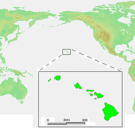
| څرگندونه | Hawaii Islands.PNG |
| سرچينه | own work based on PD map |
| ليکوال | edited by M.Minderhoud |
| اجازه (دا دوتنه بيا کارول) |
PD-demis |
| نورې بڼې | Derivative works of this file: Hawaii Islands sm.PNG |
منښتليک:
This image is in the public domain because it came from the site https://www.demis.nl/products/web-map-server/examples/ and was released by the copyright holder. Permission is granted to copy, distribute and/or modify this map since it is based on free of copyright images from: www.demis.nl. See also approval email on de.wp and its clarification.
|
| This work has been released into the public domain by its copyright holder, www.demis.nl. This applies worldwide. In some countries this may not be legally possible; if so: www.demis.nl grants anyone the right to use this work for any purpose, without any conditions, unless such conditions are required by law.
|
د دوتنې پېښليک
په يوې نېټې/يوه وخت وټوکۍ چې د هماغه وخت او نېټې دوتنه چې څنگه ښکارېده هماغسې درښکاره شي.
| نېټه/وخت | بټنوک | ډډې | کارن | تبصره | |
|---|---|---|---|---|---|
| اوسنی | ۱۳:۲۶, ۲۳ جولای ۲۰۰۶ | | ۴۳۶ × ۴۱۴ (۲۶ کيلوبايټ) | Michiel1972 | {{Information |Description= {{subst:PAGENAME}} |Source= own work based on PD map |Date= |Author= edited by M.Minderhoud |Permission= {{PD-Demis}} |other_versions= }} category:Locator maps of islands |
د دوتنې کارېدنه
داسې هېڅ کوم مخ نه شته چې د دغې دوتنې سره تړنې ولري.
د نړېوالې دوتنې کارېدنه
همدا دوتنه لاندينۍ نورې ويکي گانې کاروي:
- په de.wikipedia.org کارونې
- په en.wikipedia.org کارونې
- په es.wikipedia.org کارونې
- په et.wikipedia.org کارونې
- په fr.wikipedia.org کارونې
- په lt.wikipedia.org کارونې
- په pl.wiktionary.org کارونې
- په ru.wikibooks.org کارونې
- په tt.wikipedia.org کارونې