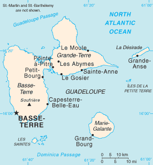
دوتنه:Guadeloupe map.png
Guadeloupe_map.png (۳۱۳ × ۳۳۶ پېکسل, د دوتنې کچه: ۱۱ کيلوبايټ, MIME بڼه: image/png)
د دوتنې پېښليک
په يوې نېټې/يوه وخت وټوکۍ چې د هماغه وخت او نېټې دوتنه چې څنگه ښکارېده هماغسې درښکاره شي.
| نېټه/وخت | بټنوک | ډډې | کارن | تبصره | |
|---|---|---|---|---|---|
| اوسنی | ۱۹:۱۳, ۳۰ اکتوبر ۲۰۲۱ |  | ۳۱۳ × ۳۳۶ (۱۱ کيلوبايټ) | Auguel | Remove frame |
| ۰۹:۵۸, ۱ جولای ۲۰۰۶ |  | ۳۱۵ × ۳۳۷ (۱۰ کيلوبايټ) | ArturM | Map of the French overseas département of Guadeloupe from the CIA World Factbook. http://www.cia.gov/cia/publications/factbook/geos/gp.html {{PD-USGov-CIA-WF}} |
د دوتنې کارېدنه
دا لاندينی مخ د همدې دوتنې سره تړنې لري:
د نړېوالې دوتنې کارېدنه
همدا دوتنه لاندينۍ نورې ويکي گانې کاروي:
- په af.wikipedia.org کارونې
- په ar.wikipedia.org کارونې
- په azb.wikipedia.org کارونې
- په az.wikipedia.org کارونې
- په ban.wikipedia.org کارونې
- په be-tarask.wikipedia.org کارونې
- په bg.wikipedia.org کارونې
- په bn.wikipedia.org کارونې
- په br.wikipedia.org کارونې
- په bs.wikipedia.org کارونې
- په bug.wikipedia.org کارونې
- په ca.wikipedia.org کارونې
- په ceb.wikipedia.org کارونې
- په cs.wikipedia.org کارونې
- په cy.wikipedia.org کارونې
- په da.wikipedia.org کارونې
- په de.wikipedia.org کارونې
- په dsb.wikipedia.org کارونې
- په el.wikipedia.org کارونې
- په en.wikipedia.org کارونې
- Guadeloupe
- Communes of the Guadeloupe department
- Grande-Terre
- La Désirade
- Marie-Galante
- List of airports in Guadeloupe
- Dominica Passage
- Guadeloupe Passage
- Portal:Caribbean/Selected geography article
- Portal:Caribbean/Selected geography article/13
- Petite Terre Islands
- Index of Guadeloupe-related articles
- Troude's expedition to the Caribbean
- 2009 French Caribbean general strikes
- Action of 22 January 1809
- Invasion of Guadeloupe (1810)
- Siege of Guadeloupe
- List of amphibians and reptiles of Guadeloupe
- Les Saintes Passage
- Marie-Galante Passage
- Module:Location map/data/Guadeloupe/doc
- Invasion of Guadeloupe (1815)
- Petite Terre Islands National Nature Reserve
د دې دوتنې نورې نړېوالې کارېدنې کتل.


