
دوتنه:Antarctica, New Zealand territorial claim.svg

Size of this PNG preview of this SVG file: ۶۰۰ × ۶۰۰ پېکسل. نورې ژورليدنې: ۲۴۰ × ۲۴۰ پېکسل | ۴۸۰ × ۴۸۰ پېکسل | ۷۶۸ × ۷۶۸ پېکسل | ۱٬۰۲۴ × ۱٬۰۲۴ پېکسل | ۲٬۰۴۸ × ۲٬۰۴۸ پېکسل | ۸۰۶ × ۸۰۶ پېکسل.
اصلي دوتنه (SVG دوتنه، نومېنلي ۸۰۶ × ۸۰۶ پېکسل، د دوتنې کچه: ۶۳ کيلوبايټ)
| څرگندونه |
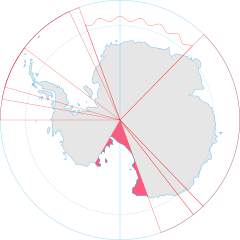
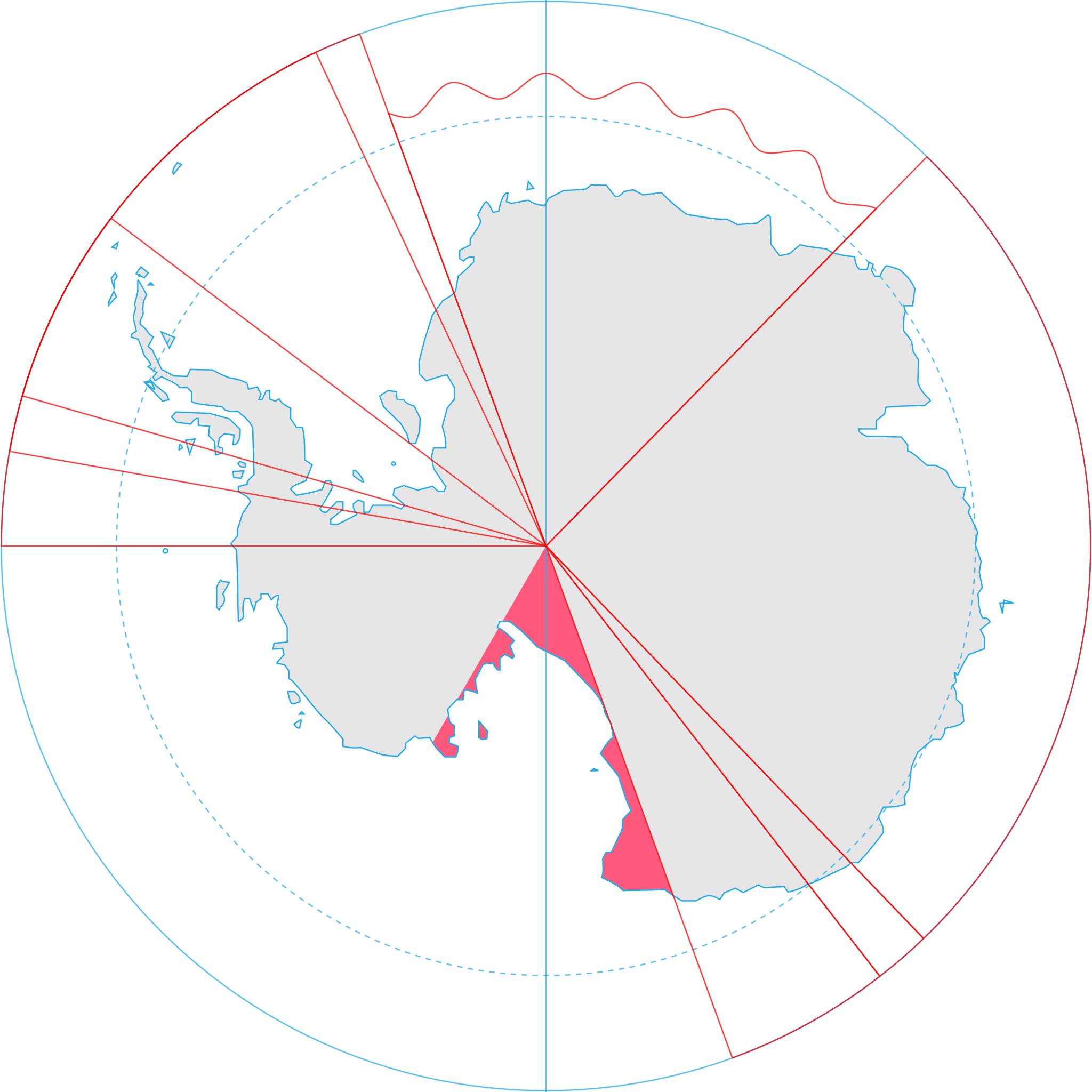
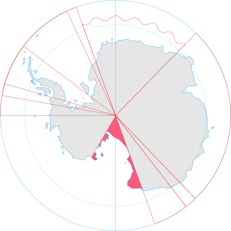
English: Map showing the territorial claim to Antarctica by the country in the filename. Also on the map are is the 60° S Parallel, Antarctic Circle, 0/180 latitude line and (in red) the borders of the claims by other states. |
| نېټه | |
| سرچينه | Generated from Antarctica by Lokal_Profil. |
| ليکوال | Lokal_Profil |
| اجازه (دا دوتنه بيا کارول) |
This file is licensed under the Creative Commons Attribution-Share Alike 2.5 Generic license. اړوندېدنه: Lokal_Profil
|
| نورې بڼې |
|
.svg)
د دوتنې پېښليک
په يوې نېټې/يوه وخت وټوکۍ چې د هماغه وخت او نېټې دوتنه چې څنگه ښکارېده هماغسې درښکاره شي.
| نېټه/وخت | بټنوک | ډډې | کارن | تبصره | |
|---|---|---|---|---|---|
| اوسنی | ۱۷:۰۹, ۸ مې ۲۰۲۰ | | ۸۰۶ × ۸۰۶ (۶۳ کيلوبايټ) | Spesh531 | Norway's claim extends south to the South Pole as of June 12 2015. Northern claim is still undefined |
| ۲۰:۵۵, ۳۰ جون ۲۰۰۸ |  | ۸۰۶ × ۸۰۶ (۶۵ کيلوبايټ) | Lokal Profil | {{Information |Description={{en|Map showing the territorial claim to Antarctica by the country in the filename. Also on the map are is the 60° S Parallel, Antarctic Circle, 0/180 latitude line and (in red) the borders of the claims by other states.}} |So |
د دوتنې کارېدنه
دا لاندينی مخ د همدې دوتنې سره تړنې لري:
د نړېوالې دوتنې کارېدنه
همدا دوتنه لاندينۍ نورې ويکي گانې کاروي:
- په af.wikipedia.org کارونې
- په an.wikipedia.org کارونې
- په ar.wikipedia.org کارونې
- په az.wikipedia.org کارونې
- په ca.wikipedia.org کارونې
- په chr.wikipedia.org کارونې
- په ckb.wikipedia.org کارونې
- په cs.wikipedia.org کارونې
- په de.wikipedia.org کارونې
- په diq.wikipedia.org کارونې
- په el.wikipedia.org کارونې
- په en.wikipedia.org کارونې
- په es.wikipedia.org کارونې
- په et.wikipedia.org کارونې
- په fa.wikipedia.org کارونې
- په fi.wikipedia.org کارونې
- په frr.wikipedia.org کارونې
- په fr.wikipedia.org کارونې
- په gl.wikipedia.org کارونې
- په gv.wikipedia.org کارونې
- په hi.wikipedia.org کارونې
- په hu.wikipedia.org کارونې
- په id.wikipedia.org کارونې
- په ilo.wikipedia.org کارونې
- په it.wikipedia.org کارونې
- په ja.wikipedia.org کارونې
- په ko.wikipedia.org کارونې
د دې دوتنې نورې نړېوالې کارېدنې کتل.