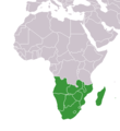
دوتنه:Africa-countries-southern.png
Africa-countries-southern.png (۳۶۰ × ۳۹۲ پېکسل, د دوتنې کچه: ۱۰ کيلوبايټ, MIME بڼه: image/png)
د دوتنې پېښليک
په يوې نېټې/يوه وخت وټوکۍ چې د هماغه وخت او نېټې دوتنه چې څنگه ښکارېده هماغسې درښکاره شي.
| نېټه/وخت | بټنوک | ډډې | کارن | تبصره | |
|---|---|---|---|---|---|
| اوسنی | ۱۹:۰۲, ۱۷ مارچ ۲۰۱۸ |  | ۳۶۰ × ۳۹۲ (۱۰ کيلوبايټ) | Maphobbyist | Montenegro border |
| ۲۰:۰۱, ۹ جولای ۲۰۱۱ |  | ۳۶۰ × ۳۹۲ (۱۳ کيلوبايټ) | Maphobbyist | South Sudan has become independent on July 9, 2011. Sudan and South Sudan are shown with the new international border between them. | |
| ۱۱:۱۳, ۵ مې ۲۰۰۶ |  | ۳۶۰ × ۳۹۲ (۴ کيلوبايټ) | Hautala | optimized with png | |
| ۱۷:۱۱, ۲۸ ډيسمبر ۲۰۰۴ |  | ۳۶۰ × ۳۹۲ (۱۳ کيلوبايټ) | Maximaximax | countries of southern Africa (from en:) {{GFDL}} |
د دوتنې کارېدنه
دا لاندينی مخ د همدې دوتنې سره تړنې لري:
د نړېوالې دوتنې کارېدنه
همدا دوتنه لاندينۍ نورې ويکي گانې کاروي:
- په incubator.wikimedia.org کارونې
- په mk.wikipedia.org کارونې
- په nso.wikipedia.org کارونې
- په oc.wikipedia.org کارونې
- په pl.wiktionary.org کارونې
- په pt.wikipedia.org کارونې
- په ro.wikipedia.org کارونې
- په rue.wikipedia.org کارونې
- په ru.wikipedia.org کارونې
- په sl.wikipedia.org کارونې
- په sv.wikipedia.org کارونې
- په sv.wikinews.org کارونې
- په sw.wikipedia.org کارونې
- په th.wikipedia.org کارونې
- په tk.wikipedia.org کارونې
- په tr.wikipedia.org کارونې
- په tr.wiktionary.org کارونې
- په uk.wikipedia.org کارونې
- په uk.wiktionary.org کارونې
- په ur.wikipedia.org کارونې
- په vi.wikipedia.org کارونې
- په wa.wikipedia.org کارونې
- په wo.wikipedia.org کارونې
- په zh.wikipedia.org کارونې


