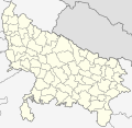
دوتنه:Uttar Pradesh locator map.svg

Size of this PNG preview of this SVG file: ۶۱۵ × ۵۹۹ پېکسل. نورې ژورليدنې: ۲۴۶ × ۲۴۰ پېکسل | ۴۹۲ × ۴۸۰ پېکسل | ۷۸۸ × ۷۶۸ پېکسل | ۱٬۰۵۱ × ۱٬۰۲۴ پېکسل | ۲٬۱۰۱ × ۲٬۰۴۸ پېکسل | ۹۰۹ × ۸۸۶ پېکسل.
اصلي دوتنه (SVG دوتنه، نومېنلي ۹۰۹ × ۸۸۶ پېکسل، د دوتنې کچه: ۸۳۸ کيلوبايټ)
د دوتنې پېښليک
په يوې نېټې/يوه وخت وټوکۍ چې د هماغه وخت او نېټې دوتنه چې څنگه ښکارېده هماغسې درښکاره شي.
| نېټه/وخت | بټنوک | ډډې | کارن | تبصره | |
|---|---|---|---|---|---|
| اوسنی | ۰۳:۱۱, ۸ جنوري ۲۰۲۱ |  | ۹۰۹ × ۸۸۶ (۸۳۸ کيلوبايټ) | C1MM | Updated districts, made more accurate boundaries |
| ۲۳:۳۲, ۶ مارچ ۲۰۱۱ |  | ۲٬۴۰۰ × ۲٬۵۱۵ (۱۳۷ کيلوبايټ) | Plasticspork | Use more neutral colouring | |
| ۲۱:۳۴, ۵ نومبر ۲۰۰۹ |  | ۲٬۴۰۰ × ۲٬۵۱۵ (۱۳۷ کيلوبايټ) | File Upload Bot (Magnus Manske) | {{BotMoveToCommons|en.wikipedia|year={{subst:CURRENTYEAR}}|month={{subst:CURRENTMONTHNAME}}|day={{subst:CURRENTDAY}}}} {{Information |Description={{en|This map has been created by Faiz Haider, it is based on [http://india.gov.in/m |
د دوتنې کارېدنه
داسې هېڅ کوم مخ نه شته چې د دغې دوتنې سره تړنې ولري.
د نړېوالې دوتنې کارېدنه
همدا دوتنه لاندينۍ نورې ويکي گانې کاروي:
- په awa.wikipedia.org کارونې
- په bh.wikipedia.org کارونې
- उत्तर प्रदेश
- गोरखपुर जिला
- गाजीपुर जिला
- रसड़ा
- गोरखपुर
- कुशीनगर जिला
- टेम्पलेट:उत्तर प्रदेश
- उत्तर प्रदेश के मंडल सभ के लिस्ट
- औंड़िहार
- रेवती, बलियाँ जिला
- चितबड़ागाँव
- बेल्थरा रोड
- गड़वार
- नगरा
- फेफना
- सहतवार
- उत्तर प्रदेश के जिला सभ के लिस्ट
- टेम्पलेट:Uttar Pradesh topics
- उत्तर प्रदेश पुलिस
- आजमगढ़ मंडल
- गोरखपुर मंडल
- इलाहाबाद मंडल
- वाराणसी मंडल
- जनसंख्या अनुसार उत्तर प्रदेश के शहरन के लिस्ट
- बस्ती मंडल
- आगरा मंडल
- अलीगढ़ मंडल
- په ceb.wikipedia.org کارونې
- په en.wikipedia.org کارونې
- Uttar Pradesh
- List of districts of Uttar Pradesh
- Urdu literature
- List of chief ministers of Uttar Pradesh
- Administrative divisions of Uttar Pradesh
- User talk:Planemad/Infobox Indian Landmark
- Template:Uttar Pradesh topics
- User:Faizhaider/gallery
- Noida ATS Shootout
- Pratapgarh stampede
- Chak Gharpur
- Climate of Uttar Pradesh
- List of cities in Uttar Pradesh by population
- List of urban agglomerations in Uttar Pradesh
- Uttar Pradesh Tourism
- Clean UP, Green UP
- List of urban local bodies in Uttar Pradesh
- په fa.wikipedia.org کارونې
د دې دوتنې نورې نړېوالې کارېدنې کتل.
