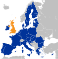
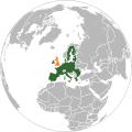
دوتنه:Location map of the United Kingdom and the European Union.svg

Size of this PNG preview of this SVG file: ۵۸۷ × ۶۰۰ پېکسل. نورې ژورليدنې: ۲۳۵ × ۲۴۰ پېکسل | ۴۷۰ × ۴۸۰ پېکسل | ۷۵۲ × ۷۶۸ پېکسل | ۱٬۰۰۲ × ۱٬۰۲۴ پېکسل | ۲٬۰۰۴ × ۲٬۰۴۸ پېکسل | ۵۹۳ × ۶۰۶ پېکسل.
اصلي دوتنه (SVG دوتنه، نومېنلي ۵۹۳ × ۶۰۶ پېکسل، د دوتنې کچه: ۷۰۸ کيلوبايټ)
د دوتنې پېښليک
په يوې نېټې/يوه وخت وټوکۍ چې د هماغه وخت او نېټې دوتنه چې څنگه ښکارېده هماغسې درښکاره شي.
| نېټه/وخت | بټنوک | ډډې | کارن | تبصره | |
|---|---|---|---|---|---|
| اوسنی | ۱۰:۱۰, ۲۷ ډيسمبر ۲۰۲۲ |  | ۵۹۳ × ۶۰۶ (۷۰۸ کيلوبايټ) | Iktsokh | Correction of borders |
| ۰۳:۰۳, ۲۷ مارچ ۲۰۱۹ |  | ۵۹۳ × ۶۰۶ (۷۰۲ کيلوبايټ) | Nice4What | Reverted to version as of 08:03, 28 August 2016 (UTC) Northern Cyprus is shown as part as Cyprus in all other EU maps | |
| ۱۶:۵۵, ۲ فبروري ۲۰۱۷ |  | ۵۹۳ × ۶۰۶ (۷۰۴ کيلوبايټ) | RaviC | Shaded regions with partial EU treaty application (Customs Union) per https://www.gov.uk/government/uploads/system/uploads/attachment_data/file/588948/The_United_Kingdoms_exit_from_and_partnership_with_the_EU_Web.pdf | |
| ۰۵:۵۲, ۲۹ اگسټ ۲۰۱۶ |  | ۵۹۳ × ۶۰۶ (۷۰۴ کيلوبايټ) | Turnless | Reverted to version as of 12:49, 25 June 2016 (UTC) COM:OVERWRITE violation, you can create a new map if you'd like. | |
| ۰۸:۰۳, ۲۸ اگسټ ۲۰۱۶ |  | ۵۹۳ × ۶۰۶ (۷۰۲ کيلوبايټ) | Bazonka | Northern Cyprus is de jure part of the EU | |
| ۱۲:۴۹, ۲۵ جون ۲۰۱۶ |  | ۵۹۳ × ۶۰۶ (۷۰۴ کيلوبايټ) | Steinsplitter | Reverted to version as of 17:57, 18 June 2016 (UTC): COM:OVERWRITE violation | |
| ۱۲:۰۸, ۲۵ جون ۲۰۱۶ |  | ۷۹۲ × ۷۹۲ (۲٫۸۷ مېگابايټ) | ThiefOfBagdad | Full EU view | |
| ۱۷:۵۷, ۱۸ جون ۲۰۱۶ |  | ۵۹۳ × ۶۰۶ (۷۰۴ کيلوبايټ) | RaviC | + Gib | |
| ۰۵:۳۷, ۱۶ جون ۲۰۱۶ |  | ۵۹۳ × ۶۰۶ (۷۰۳ کيلوبايټ) | Turnless | Update layout | |
| ۱۰:۳۰, ۲۷ مې ۲۰۱۶ |  | ۶۳۲ × ۶۳۷ (۷۶۵ کيلوبايټ) | Furfur | new color, better visibility |
د دوتنې کارېدنه
دا لاندينی مخ د همدې دوتنې سره تړنې لري:
د نړېوالې دوتنې کارېدنه
همدا دوتنه لاندينۍ نورې ويکي گانې کاروي:
- په af.wikipedia.org کارونې
- په ar.wikipedia.org کارونې
- په ast.wikipedia.org کارونې
- په az.wikipedia.org کارونې
- په ba.wikipedia.org کارونې
- په be.wikipedia.org کارونې
- په bg.wikipedia.org کارونې
- په bh.wikipedia.org کارونې
- په bn.wikipedia.org کارونې
- په br.wikipedia.org کارونې
- په bs.wikipedia.org کارونې
- په cs.wikipedia.org کارونې
- په cy.wikipedia.org کارونې
- په da.wikipedia.org کارونې
- په de.wikipedia.org کارونې
- 2016
- Benutzer:Kallewirsch
- EU-Austritt des Vereinigten Königreichs
- Benutzer:Tmid
- Benutzer:Anton-kurt/Schaufenster 2016
- Wikipedia:Hauptseite/Archiv/24. Juni 2016
- Wikipedia:Hauptseite/Archiv/3. November 2016
- März 2017
- Wikipedia:Hauptseite/Archiv/29. März 2017
- Wikipedia:Kartenwerkstatt/Archiv/2017-04
- Wikipedia:Hauptseite/Archiv/20. Juni 2017
- Wikipedia:Hauptseite/Archiv/15. November 2018
- Wikipedia:Hauptseite/Archiv/25. November 2018
- Wikipedia:Hauptseite/Archiv/26. November 2018
- EU-Mitgliedschaft des Vereinigten Königreichs
- Wikipedia:Kurier/Ausgabe 2 2020
- Handels- und Kooperationsabkommen zwischen der Europäischen Union und dem Vereinigten Königreich
- Benutzer:Gabas/Meistaufgerufene Artikel
- په din.wikipedia.org کارونې
- په diq.wikipedia.org کارونې
- په en.wikipedia.org کارونې
- User:ArcMachaon/sandbox
- Brexit
- Wikipedia:In the news/Candidates/June 2016
- Template talk:United Kingdom in the European Union
- Wikipedia:Top 25 Report/June 19 to 25, 2016
- Wikipedia:Wikipedia Signpost/2016-07-04/Traffic report
- Wikipedia:Wikipedia Signpost/Single/2016-07-04
- Wikipedia:Top 25 Report/June 26 to July 2, 2016
- Talk:Brexit/Archive 1
د دې دوتنې نورې نړېوالې کارېدنې کتل.
