
دوتنه:LocationCentralMiddleAfrica.png
تر دې کچې لوړې بېلن نښې نشته.
LocationCentralMiddleAfrica.png (۳۶۰ × ۳۹۲ پېکسل, د دوتنې کچه: ۱۱ کيلوبايټ, MIME بڼه: image/png)
لنډيز
| څرگندونه |
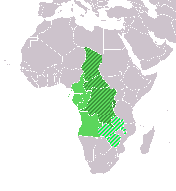
Map: Africa – Central/Middle Africa
|
| نېټه | ۴ فبروري ۲۰۰۶ (original upload date) |
| سرچينه | No machine-readable source provided. Own work assumed (based on copyright claims). |
| ليکوال | No machine-readable author provided. E Pluribus Anthony~commonswiki assumed (based on copyright claims). |
منښتليک:
| I, the copyright holder of this work, release this work into the public domain. This applies worldwide. In some countries this may not be legally possible; if so: I grant anyone the right to use this work for any purpose, without any conditions, unless such conditions are required by law. |
د دوتنې پېښليک
په يوې نېټې/يوه وخت وټوکۍ چې د هماغه وخت او نېټې دوتنه چې څنگه ښکارېده هماغسې درښکاره شي.
| نېټه/وخت | بټنوک | ډډې | کارن | تبصره | |
|---|---|---|---|---|---|
| اوسنی | ۱۸:۱۳, ۱۷ مارچ ۲۰۱۸ | | ۳۶۰ × ۳۹۲ (۱۱ کيلوبايټ) | Maphobbyist | Upload |
| ۲۱:۰۱, ۹ جولای ۲۰۱۱ |  | ۳۶۰ × ۳۹۲ (۱۴ کيلوبايټ) | Maphobbyist | South Sudan has become independent on July 9, 2011. Sudan and South Sudan are shown with the new international border between them. | |
| ۰۸:۳۵, ۱۱ ډيسمبر ۲۰۰۷ |  | ۳۶۰ × ۳۹۲ (۱۴ کيلوبايټ) | Hoshie | added Cabinda and Montenegro | |
| ۱۴:۰۴, ۳۰ ډيسمبر ۲۰۰۶ |  | ۳۶۰ × ۳۹۲ (۹ کيلوبايټ) | Henrygb~commonswiki | Reverted to earlier revision | |
| ۰۶:۰۱, ۱ اپرېل ۲۰۰۶ |  | ۳۶۰ × ۳۹۲ (۱۴ کيلوبايټ) | Aris Katsaris | cleaner map -- no need to include defunct federation which confuses the map's purpose. | |
| ۱۷:۴۰, ۴ فبروري ۲۰۰۶ |  | ۳۶۰ × ۳۹۲ (۹ کيلوبايټ) | E Pluribus Anthony~commonswiki | Map: Central/Middle Africa (location) |
د دوتنې کارېدنه
دا لاندينی مخ د همدې دوتنې سره تړنې لري:
د نړېوالې دوتنې کارېدنه
همدا دوتنه لاندينۍ نورې ويکي گانې کاروي:
- په ace.wikipedia.org کارونې
- په af.wikipedia.org کارونې
- په als.wikipedia.org کارونې
- په am.wikipedia.org کارونې
- په ar.wikipedia.org کارونې
- ليبيا
- جيبوتي
- موريتانيا
- تونس
- السودان
- الصحراء الغربية
- أنغولا
- أوغندا
- إسبانيا
- تشاد
- النيجر
- مالي
- السنغال
- غامبيا
- غينيا بيساو
- غينيا
- سيراليون
- ليبيريا
- غانا
- توغو
- بنين
- بوركينا فاسو
- الصومال
- كينيا
- تنزانيا
- الغابون
- زامبيا
- موزمبيق
- زيمبابوي
- البرتغال
- الكاميرون
- جمهورية الكونغو الديمقراطية
- بوتسوانا
- جنوب إفريقيا
- جمهورية إفريقيا الوسطى
- جمهورية الكونغو
- سيشل
- ناميبيا
- مدغشقر
- ليسوتو
- موريشيوس
- نهر النيل
د دې دوتنې نورې نړېوالې کارېدنې کتل.