
دوتنه:Karte A Tirol I.svg

Size of this PNG preview of this SVG file: ۸۰۰ × ۴۵۷ پېکسل. نورې ژورليدنې: ۳۲۰ × ۱۸۳ پېکسل | ۶۴۰ × ۳۶۶ پېکسل | ۱٬۰۲۴ × ۵۸۵ پېکسل | ۱٬۲۸۰ × ۷۳۱ پېکسل | ۲٬۵۶۰ × ۱٬۴۶۳ پېکسل.
اصلي دوتنه (SVG دوتنه، نومېنلي ۱٬۰۵۰ × ۶۰۰ پېکسل، د دوتنې کچه: ۱۶ کيلوبايټ)
لنډيز
| څرگندونه |
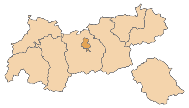
English: Map of the Austrian State Tyrol, highlighting Innsbruck
Deutsch: Karte des österreichischen Bundeslandes Tirol, Innsbruck hervorgehoben |
| نېټه | |
| سرچينه | شخصي اثر |
| ليکوال | AleXXw |
| SVG genesis |
منښتليک:
| I, the copyright holder of this work, release this work into the public domain. This applies worldwide. In some countries this may not be legally possible; if so: I grant anyone the right to use this work for any purpose, without any conditions, unless such conditions are required by law. |
د دوتنې پېښليک
په يوې نېټې/يوه وخت وټوکۍ چې د هماغه وخت او نېټې دوتنه چې څنگه ښکارېده هماغسې درښکاره شي.
| نېټه/وخت | بټنوک | ډډې | کارن | تبصره | |
|---|---|---|---|---|---|
| اوسنی | ۱۲:۵۶, ۱۰ جولای ۲۰۱۰ | | ۱٬۰۵۰ × ۶۰۰ (۱۶ کيلوبايټ) | AleXXw | == {{int:filedesc}} == {{Information |Description={{en|1=Map of the Austrian State Tyrol, highlighting Innsbruck}} {{de|1=Karte des österreichischen Bundeslandes Tirol, Innsbruck hervorgehoben}} |Source=Eigenes Werk (own work) |Author=[[User:AleXXw|AleXX |
د دوتنې کارېدنه
دا لاندينی مخ د همدې دوتنې سره تړنې لري:
د نړېوالې دوتنې کارېدنه
همدا دوتنه لاندينۍ نورې ويکي گانې کاروي:
- په ar.wikipedia.org کارونې
- په arz.wikipedia.org کارونې
- په ast.wikipedia.org کارونې
- په ca.wikipedia.org کارونې
- په ceb.wikipedia.org کارونې
- په de.wikipedia.org کارونې
- په diq.wikipedia.org کارونې
- په el.wikipedia.org کارونې
- په es.wikipedia.org کارونې
- په et.wikipedia.org کارونې
- په eu.wikipedia.org کارونې
- په ga.wikipedia.org کارونې
- په gl.wikipedia.org کارونې
- په hu.wikipedia.org کارونې
- په ia.wikipedia.org کارونې
- په ilo.wikipedia.org کارونې
- په it.wikipedia.org کارونې
- په ja.wikipedia.org کارونې
- په la.wikipedia.org کارونې
- په lmo.wikipedia.org کارونې
- په mn.wikipedia.org کارونې
- په se.wikipedia.org کارونې
- په sk.wikipedia.org کارونې
- په sl.wikipedia.org کارونې
- په sv.wikipedia.org کارونې
- په vi.wikipedia.org کارونې
- په www.wikidata.org کارونې