
دوتنه:Kampala District Uganda.png

د همدې ليدنې کچه: ۵۲۸ × ۶۰۰ پېکسل. نورې ژورليدنې: ۲۱۱ × ۲۴۰ پېکسل | ۴۲۲ × ۴۸۰ پېکسل | ۶۶۱ × ۷۵۱ پېکسل.
اصلي دوتنه (۶۶۱ × ۷۵۱ پېکسل, د دوتنې کچه: ۳۱ کيلوبايټ, MIME بڼه: image/png)
| څرگندونه |
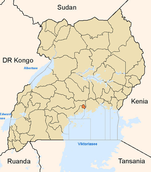
English: Map showing the position of the district Kampala in Uganda.
Deutsch: Karte, die die Position des Distriktes Kampala in Uganda anzeigt.
Plattdüütsch: Koort, de de Positschoon vun’n Distrikt Kampala in Uganda wiest. |
||
| سرچينه | شخصي اثر | ||
| ليکوال | |||
| اجازه (دا دوتنه بيا کارول) |
|
د دوتنې پېښليک
په يوې نېټې/يوه وخت وټوکۍ چې د هماغه وخت او نېټې دوتنه چې څنگه ښکارېده هماغسې درښکاره شي.
| نېټه/وخت | بټنوک | ډډې | کارن | تبصره | |
|---|---|---|---|---|---|
| اوسنی | ۱۷:۰۳, ۸ جون ۲۰۰۵ | | ۶۶۱ × ۷۵۱ (۳۱ کيلوبايټ) | Slomox | Map showing the position of the district Kampala in Uganda. {{GFDL}} Category:Maps of Ugandan districts |
د دوتنې کارېدنه
دا لاندينی مخ د همدې دوتنې سره تړنې لري:
د نړېوالې دوتنې کارېدنه
همدا دوتنه لاندينۍ نورې ويکي گانې کاروي:
- په ar.wikipedia.org کارونې
- په ceb.wikipedia.org کارونې
- په en.wikipedia.org کارونې
- په fa.wikipedia.org کارونې
- په fi.wikipedia.org کارونې
- په fo.wikipedia.org کارونې
- په fr.wikinews.org کارونې
- په gl.wikipedia.org کارونې
- په ha.wikipedia.org کارونې
- په ig.wikipedia.org کارونې
- په is.wikipedia.org کارونې
- په ja.wikipedia.org کارونې
- په ko.wikipedia.org کارونې
- په mi.wikipedia.org کارونې
- په nds.wikipedia.org کارونې
- په oc.wikipedia.org کارونې
- په pl.wiktionary.org کارونې
- په pt.wikipedia.org کارونې
- په qu.wikipedia.org کارونې
- په sw.wikipedia.org کارونې
- په ts.wikipedia.org کارونې
- په ur.wikipedia.org کارونې
- په vo.wikipedia.org کارونې
- په www.wikidata.org کارونې
- په yo.wikipedia.org کارونې
- په zh.wikipedia.org کارونې
- په zu.wikipedia.org کارونې