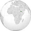
دوتنه:Eritrea (Africa orthographic projection).svg

Size of this PNG preview of this SVG file: ۵۵۰ × ۵۵۰ پېکسل. نورې ژورليدنې: ۲۴۰ × ۲۴۰ پېکسل | ۴۸۰ × ۴۸۰ پېکسل | ۷۶۸ × ۷۶۸ پېکسل | ۱٬۰۲۴ × ۱٬۰۲۴ پېکسل | ۲٬۰۴۸ × ۲٬۰۴۸ پېکسل.
اصلي دوتنه (SVG دوتنه، نومېنلي ۵۵۰ × ۵۵۰ پېکسل، د دوتنې کچه: ۱۴۱ کيلوبايټ)
د دوتنې پېښليک
په يوې نېټې/يوه وخت وټوکۍ چې د هماغه وخت او نېټې دوتنه چې څنگه ښکارېده هماغسې درښکاره شي.
| نېټه/وخت | بټنوک | ډډې | کارن | تبصره | |
|---|---|---|---|---|---|
| اوسنی | ۰۸:۵۵, ۹ اپرېل ۲۰۱۸ |  | ۵۵۰ × ۵۵۰ (۱۴۱ کيلوبايټ) | Nikki070 | Reverted to version as of 20:28, 16 December 2012 (UTC); unification |
| ۱۹:۳۷, ۱۷ مارچ ۲۰۱۷ |  | ۵۵۰ × ۵۵۰ (۱۸۵ کيلوبايټ) | Esmu Igors | Colors from the locator map of France don't seem to have enough contrast; I therefore made Africa on the map darker. | |
| ۱۹:۳۴, ۱۷ مارچ ۲۰۱۷ |  | ۵۵۰ × ۵۵۰ (۱۸۵ کيلوبايټ) | Esmu Igors | Description, at least on the en.wikipedia.org article "Eritrea" has description about Africa dark grey and the rest of the world gray. I didn't see any of this, so changed the colours as were in an analogous map for France. | |
| ۰۸:۳۷, ۱۵ مې ۲۰۱۶ |  | ۵۵۰ × ۵۵۰ (۱۸۶ کيلوبايټ) | Richard0048 | Reverted to version as of 20:52, 14 May 2016 (UTC) | |
| ۰۸:۱۵, ۱۵ مې ۲۰۱۶ |  | ۵۵۰ × ۵۵۰ (۱۸۶ کيلوبايټ) | Richard0048 | Col | |
| ۲۰:۵۲, ۱۴ مې ۲۰۱۶ |  | ۵۵۰ × ۵۵۰ (۱۸۶ کيلوبايټ) | Richard0048 | clearer borders | |
| ۲۰:۴۹, ۱۴ مې ۲۰۱۶ |  | ۵۵۰ × ۵۵۰ (۱۸۶ کيلوبايټ) | Richard0048 | Reverted to version as of 16:51, 13 December 2012 (UTC) | |
| ۲۰:۲۸, ۱۶ ډيسمبر ۲۰۱۲ |  | ۵۵۰ × ۵۵۰ (۱۴۱ کيلوبايټ) | Sémhur | Light grey version ; prominent Congo river removed | |
| ۱۶:۵۱, ۱۳ ډيسمبر ۲۰۱۲ |  | ۵۵۰ × ۵۵۰ (۱۸۶ کيلوبايټ) | Chipmunkdavis | Version with colours that greatly contrast, with South Sudan border and other fixes | |
| ۰۹:۳۴, ۱۳ ډيسمبر ۲۰۱۲ |  | ۵۵۰ × ۵۵۰ (۱۴۲ کيلوبايټ) | Sémhur | That's your pov, not mine, but please do not destroy informations! (south sudan border and few corrections) |
د دوتنې کارېدنه
دا لاندينی مخ د همدې دوتنې سره تړنې لري:
د نړېوالې دوتنې کارېدنه
همدا دوتنه لاندينۍ نورې ويکي گانې کاروي:
- په ami.wikipedia.org کارونې
- په ar.wikipedia.org کارونې
- په arz.wikipedia.org کارونې
- په avk.wikipedia.org کارونې
- په azb.wikipedia.org کارونې
- په az.wiktionary.org کارونې
- په be-tarask.wikipedia.org کارونې
- په bg.wikipedia.org کارونې
- په bh.wikipedia.org کارونې
- په bi.wikipedia.org کارونې
- په ca.wikipedia.org کارونې
- په ceb.wikipedia.org کارونې
- په ckb.wikipedia.org کارونې
- په cs.wikipedia.org کارونې
- په cu.wikipedia.org کارونې
- په da.wikipedia.org کارونې
- په de.wikivoyage.org کارونې
- په din.wikipedia.org کارونې
- په dv.wikipedia.org کارونې
- په el.wikipedia.org کارونې
- په en.wikipedia.org کارونې
- په en.wikinews.org کارونې
- په en.wikivoyage.org کارونې
- په eo.wikipedia.org کارونې
- په es.wikipedia.org کارونې
- په eu.wikipedia.org کارونې
- په fa.wikipedia.org کارونې
- په ff.wikipedia.org کارونې
- په fi.wikipedia.org کارونې
- په fr.wikipedia.org کارونې
- په fr.wikinews.org کارونې
- په gl.wikipedia.org کارونې
- په ha.wikipedia.org کارونې
- په he.wikipedia.org کارونې
- په hr.wikipedia.org کارونې
د دې دوتنې نورې نړېوالې کارېدنې کتل.
