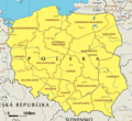
دوتنه:EC map of poland.png
ښکارېدونکې بڼه
EC_map_of_poland.png (۶۰۰ × ۵۴۸ پېکسل, د دوتنې کچه: ۵۹ کيلوبايټ, MIME بڼه: image/png)
د دوتنې پېښليک
په يوې نېټې/يوه وخت وټوکۍ چې د هماغه وخت او نېټې دوتنه چې څنگه ښکارېده هماغسې درښکاره شي.
| نېټه/وخت | بټنوک | ډډې | کارن | تبصره | |
|---|---|---|---|---|---|
| اوسنی | ۱۸:۰۸, ۲۶ فبروري ۲۰۰۵ |  | ۶۰۰ × ۵۴۸ (۵۹ کيلوبايټ) | Micga~commonswiki |
د دوتنې کارېدنه
داسې هېڅ کوم مخ نه شته چې د دغې دوتنې سره تړنې ولري.
د نړېوالې دوتنې کارېدنه
همدا دوتنه لاندينۍ نورې ويکي گانې کاروي:
- په ace.wikipedia.org کارونې
- په br.wikipedia.org کارونې
- په bs.wikipedia.org کارونې
- په btm.wikipedia.org کارونې
- په de.wikipedia.org کارونې
- په fi.wikipedia.org کارونې
- په fy.wikipedia.org کارونې
- په id.wikipedia.org کارونې
- په incubator.wikimedia.org کارونې
- په it.wikipedia.org کارونې
- په ja.wikipedia.org کارونې
- په jv.wikipedia.org کارونې
- په nl.wikipedia.org کارونې
- په ru.wikipedia.org کارونې
- په su.wikipedia.org کارونې
- په zea.wikipedia.org کارونې
- په zh-classical.wikipedia.org کارونې
- په zh.wikipedia.org کارونې
د دې دوتنې نورې نړېوالې کارېدنې کتل.


